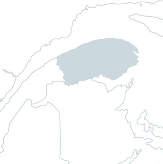
Madeleine River
The 150 kilometer long Madeleine River rises at the foot of Mont Jacques-Cartier. It flows from southwest to northeast, then turns in a half-loop to the south, finally emptying into the St-Laurent at the village of Rivière-Madeleine, halfway between Gaspé and Sainte-Anne-des-Monts.
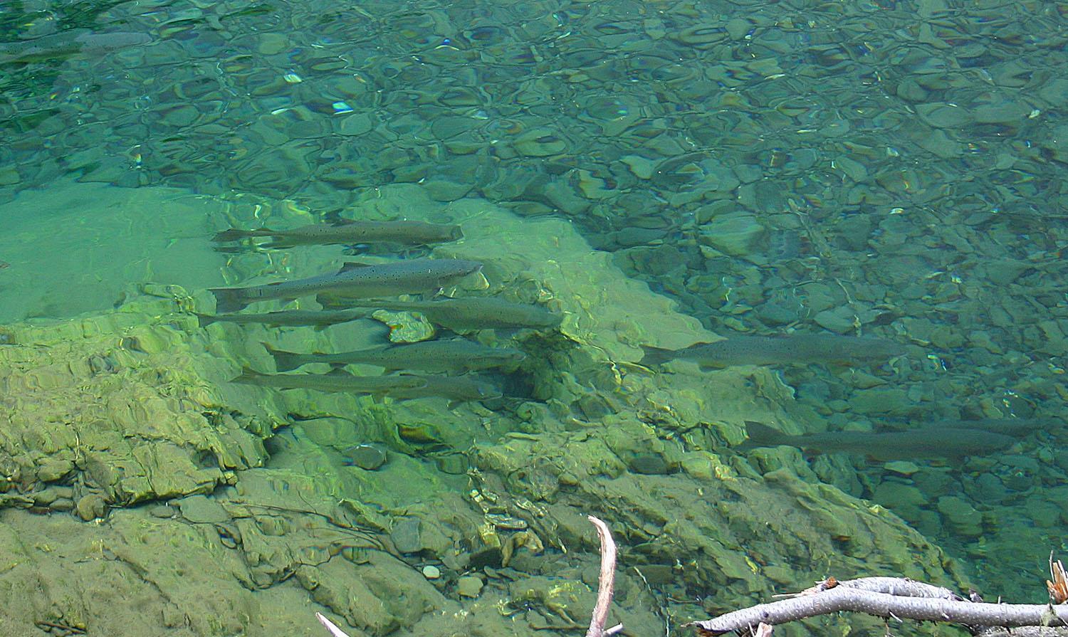
As early as 1679, there was a seigneury at Rivière Madeleine. In the 20th century, this estate was owned by forestry companies, who developed sport fishing for themselves. As the 25-metre-high Grand Falls prevented salmon from moving further upstream, the Quebec government built a fish pass in 1968. From then until the end of the 90s, this 140-metre-long tunnel, the only one of its kind in the world, combined with sustained stocking efforts, more than tripled the salmon population.
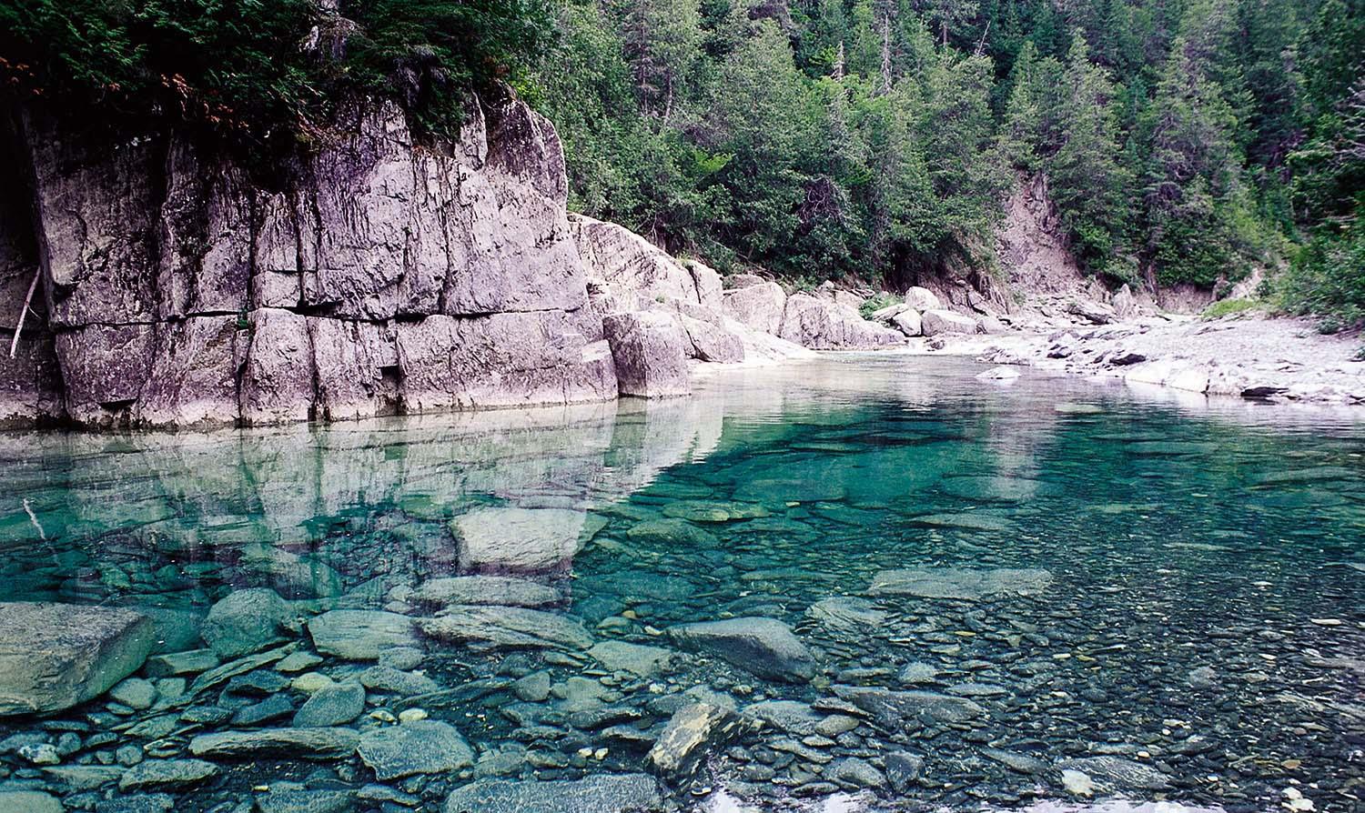
Today, the fishing territory on this waterway has the status of a salmon zec and is managed by the Société de gestion de la rivière Madeleine. You'll find clear water on a bed of gravel, pebbles and cobbles. There are 6 fishing sectors distributed along the river in both restricted draw sectors and non-restricted public sectors, for a total of 76 easily accessible pools. Salmon fishing is done by wading in 80% of the pools.
TERMS AND CONDITIONS OF ANNUAL DRAWS
The annual draw for the Madeleine River is held on November 1.
For draw sectors, winners (ranks 1 to 150) may reserve a maximum of 2 consecutive or non-consecutive fishing days for 1 or 2 people per day. The percentage of fishing days allocated is
on average 55-60% in the pre-season and 35-40% within 48 hours.
No telephone reminders will be made following the draw. Rods not sold in the pre-season draw are automatically allocated to the 48-hour draw.
For more information on the draws, click here.
To see the detailed prices for the Madeleine River, click here.