MITIS AND MISTIGOUGÈCHE RIVERS
The Mitis and Mistigougèche rivers flow through the heart of the Zec Rivière Mitis territory. The latter can be reached by taking the Chemin du Portage from the municipality of Sainte-Angèle-de-Mérici. The Mistigougèche River is also accessible via the chemin de la rivière Mistigougèche in the municipality of Les Hauteurs.
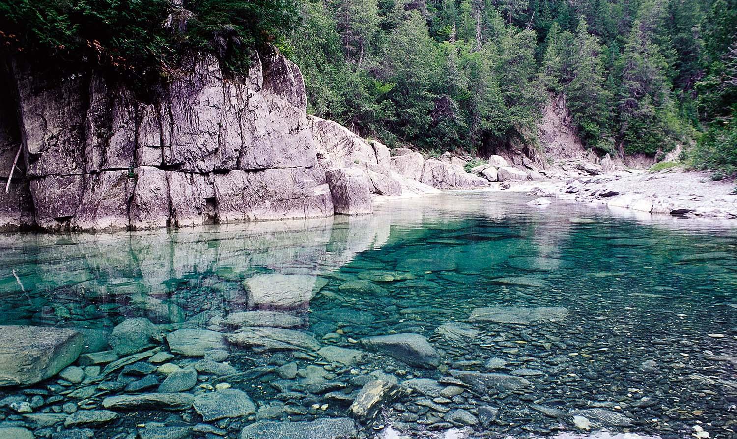
The Mitis River flows 51 kilometers north from Lac Mitis to join the St-Laurent at Sainte-Flavie, some 32 kilometers east of Rimouski. Salmon can be found on this 46 kilometer long river up to an impassable 12 meter waterfall near Lac Mitis. This winding river, with its lightly colored waters, is easily accessible via well-maintained trails. It's just a few steps from Chemin du Portage. Rivière Mitis has 33 pools divided into 2 public sectors (II & III) and 1 restricted draw sector (III-B). (Click here to see the map)
The Mistigougèche River is one of the most important tributaries of the Mitis River. It covers a distance of almost 70 kilometers before emptying into the Mitis River. A 26 kilometer stretch is accessible to salmon, more precisely to the foot of the Lac des Eaux-Mortes dike. Its confluence with the Mitis River is 25 kilometers from the St-Laurent. This dark-water river flows through a unique landscape, completely different from that of the Rivière Mitis, following a rugged, mountainous terrain. It flows through a wild, little-traveled area, offering tranquility and unique access to nature. Access is not difficult, however, with a road running alongside the river and a number of access trails. The Mistigougèche River has 6 pools within a 10 kilometer stretch of the controlled-access sector (IV).(Click here to see the map)
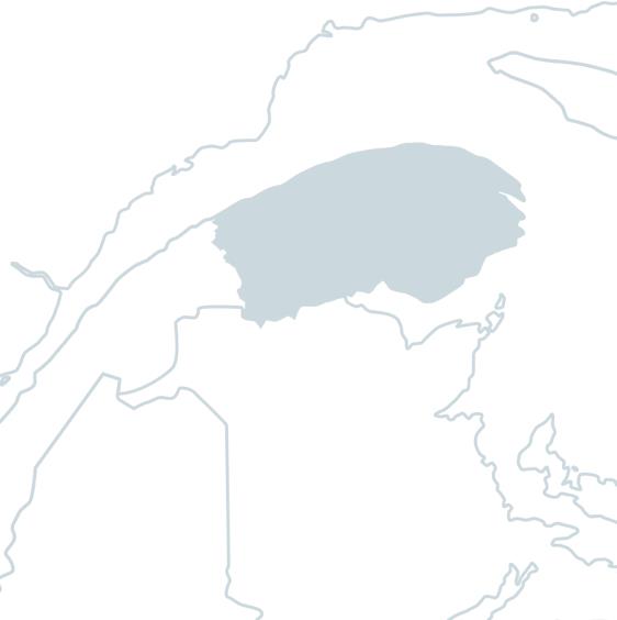
THE TERRITORY
The territory is located in Bas-Saint-Laurent, in the MRC de La Mitis, about...
- 584 kilometers from Montreal
- 356 kilometers from Quebec City
- 351 kilometers from Gaspé
- 476 kilometers from Moncton
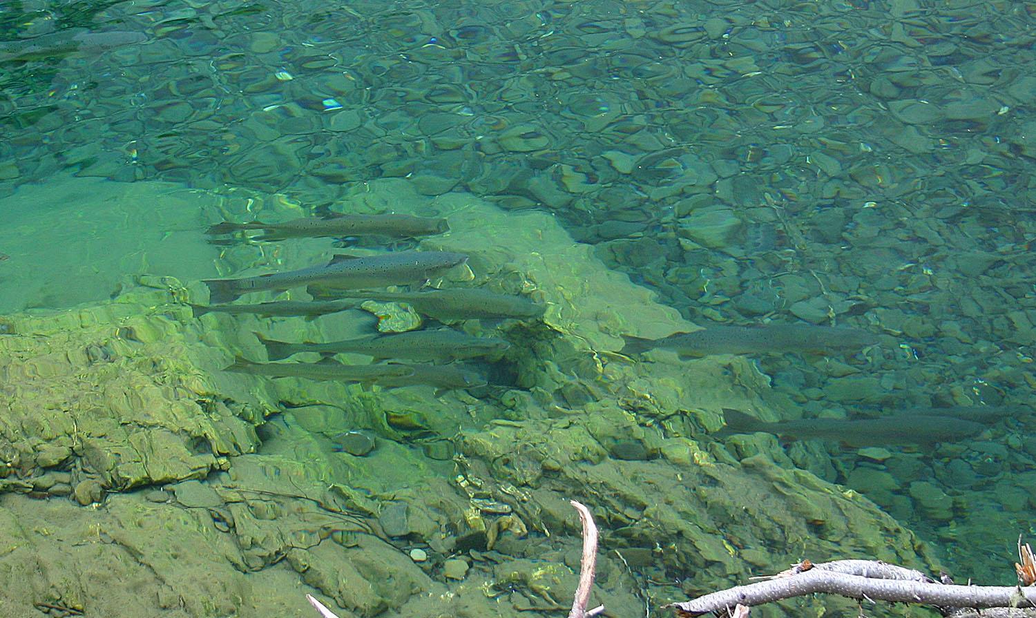
Annually, just over 1,200 salmon swim the rivers of the territory, of which just over half are madeleineaux. Captured downstream of the Mitis 2 hydroelectric dam, less than 2 kilometers from the mouth of the Mitis River, the salmon are transported nearly 10 kilometers by truck. At the end of this journey, in Sainte-Angèle-de-Mérici, they are released to continue their migration.
Founded in 1993, the Zec Rivière Mitis is committed to sustainable development and respect for the priceless Atlantic salmon resource. A dedicated organization, recent investments, nearby amenities, tranquility, a landscape of valleys and waterfalls, live the Zec Rivière Mitis experience! For more details, visit our Facebook and Instagram pages or our website.