Fishing the

Malbaie River

In brief

Malbaie River

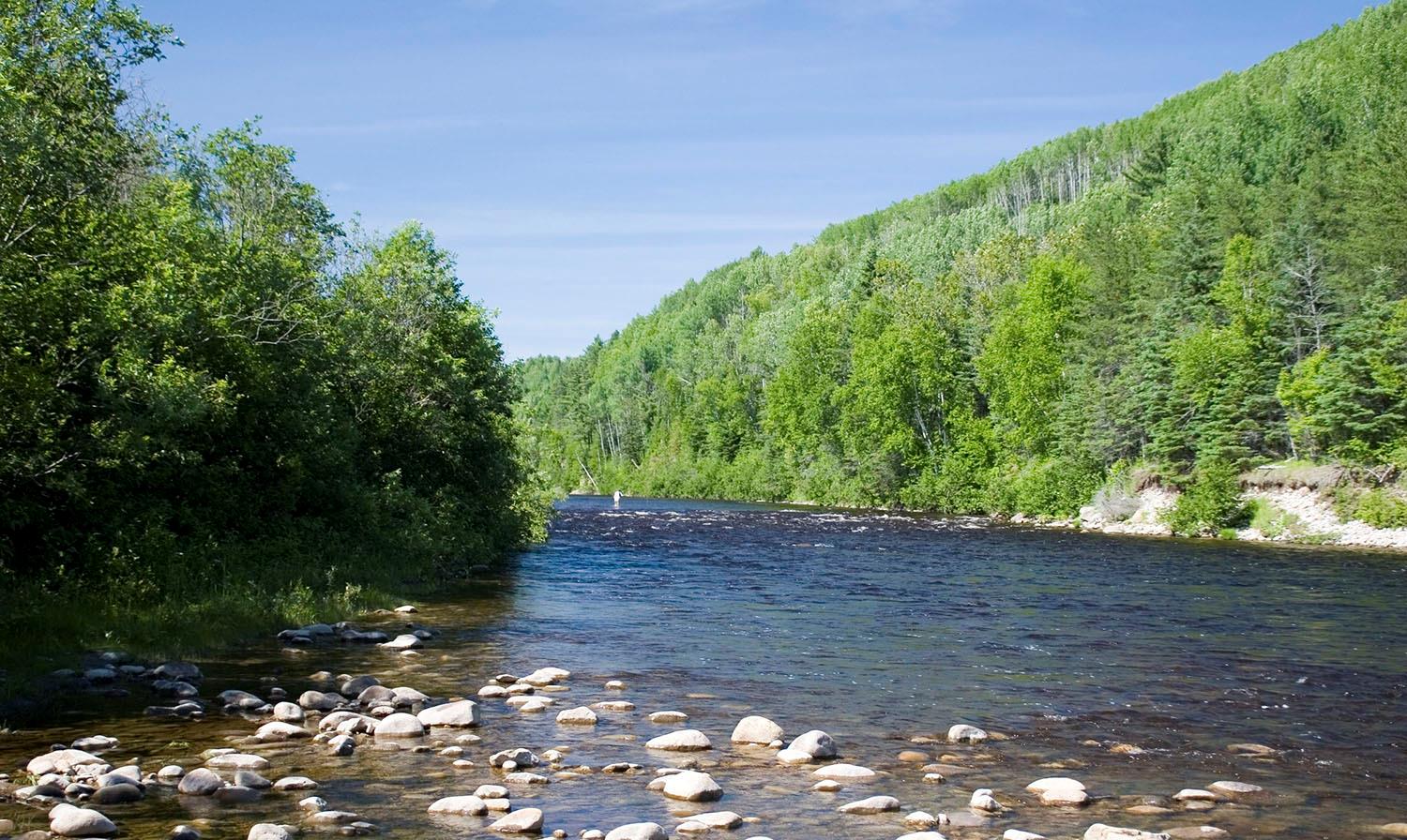
The Malbaie River, nestled in the Charlevoix World Biosphere Reserve, rises in the lake of the same name in the Laurentian Massif. It winds southeast through a deep, narrow glacial valley for 161 kilometers and a vertical drop of 820 meters. Passing through the villages of Saint-Aimé-des-Lacs and Clermont, the Rivière Malbaie reaches the municipality of La Malbaie and the St-Laurent, after passing through two national parks, Grands-Jardins and Hautes-Gorges-de-la-Rivière-Malbaie.

Over the centuries, this richly-fished river has been an important communication route, particularly for the Montagnais of the Saguenay. In the 19th century, log driving monopolized the river until 1987, when this activity came to an end. This was followed by efforts to clean up the environment, a salmon restoration project and, in 1995, the creation of the Corporation du Saumon de la rivière Malbaie. This organization manages the salmon fishery, which has been accessible since 1998.

The Rivière Malbaie offers 76 pools in 4 sectors, including 2 with limited access and 2 public. Over a distance of 40 kilometers, anglers can discover 20 easily accessible urban pools. For those who enjoy exceptional scenery, the Zec des Martres sector offers 32 pools, while the Parc national des Hautes-Gorges-de-la-Rivière-Malbaie has 24. Fishing is mainly by wading.

Whether novice or expert, anglers will appreciate this welcoming river, as well as the impressive tourist offering of the Charlevoix region, renowned for its fine dining and rich culture.

Services offered

  • Camping

  • Equipment rental

  • Guide

  • Companion

  • Bathrooms

  • Lodging

  • Cottage

  • Classes / Initiations

Conditions

River manager

Corporation Saumon de la rivière Malbaie inc.

Lenght

40 kilometers open for fishing

Type of fishing possible

Wading

Fishing season

Downstream sector: June 15 to September 15 - Zec des Martres and Parc national des Hautes-Gorges sectors: July 1 to September 15

Sectors and pools

76 pools divided into 4 sectors, including 2 draw sectors and 2 public sectors.

Daily catch limit per angler

https://www.quebec.ca/tourisme-et-loisirs/activites-sportives-et-de-plein-air/peche-sportive/

Charlevoix

Carte - Charlevoix

Access to the region

Located an hour's drive from Quebec City, Charlevoix is accessible via Route 138. Two secondary roads, 381 and 170, link the region to the Saguenay region. The region is also accessible by bus and train.

Image | Charlevoix

Breathtaking scenery

Two rivers, on the north shore of the St-Laurent east of Quebec City, offer superb landscapes of wild, rugged valleys. The region is a delight for artists, gourmets and... fishermen!

These salmon rivers, the first north of the St-Laurent, originate in a massif dotted with wonderful national parks, and flow through forested valleys of unspoiled nature. The water has reflections of brown and red earth. Downstream, these rivers meander through bucolic settings before emptying into the river at the height of splendid towns and villages. The scenery is breathtakingly beautiful, and can be admired from a number of well-maintained trails.

It's easy for anglers to find places to stay and eat. From bed & breakfasts to sumptuous hotels, from family-run kitchens to gourmet relays, the possibilities are endless and can suit any budget. What's more, the Charlevoix region offers an equally considerable variety of tourist and cultural attractions, some of which are world-renowned.

Bannière | Image